

Unless you’ve got some sort of super-powered Google Maps combo GPS and earbud from the future, chances are you’ve had to consult a map in your quest for the most delicious eats or places to chill in New York City.
But when we look at those maps, we feel ourselves tumbling into a rabbit hole of confusing lines and streets.
Who knew there were two DeKalb Avenues?
Well, not that you were looking for an answer to that particular question, but Anthony Denaro did.
Anthony Denaro undertook this beastly transit system that gets most of us around NYC and created a legible map, borough by borough. And he’s been making some excellent points along the way!
Denoro drew a fine line, however, when he noted that “[i]n the places where people are waiting there to ride the bus, you can’t find the map to navigate it.”
[anad]
So how did he get crackin’ on this creation? He began with two simple notions: that most New Yorkers are aware of the major streets and the subway stations. Right off the bat, he admits that this dope development “isn’t a tourist map.”
If anything, it’s another great tool for becoming an even more pro commuter.
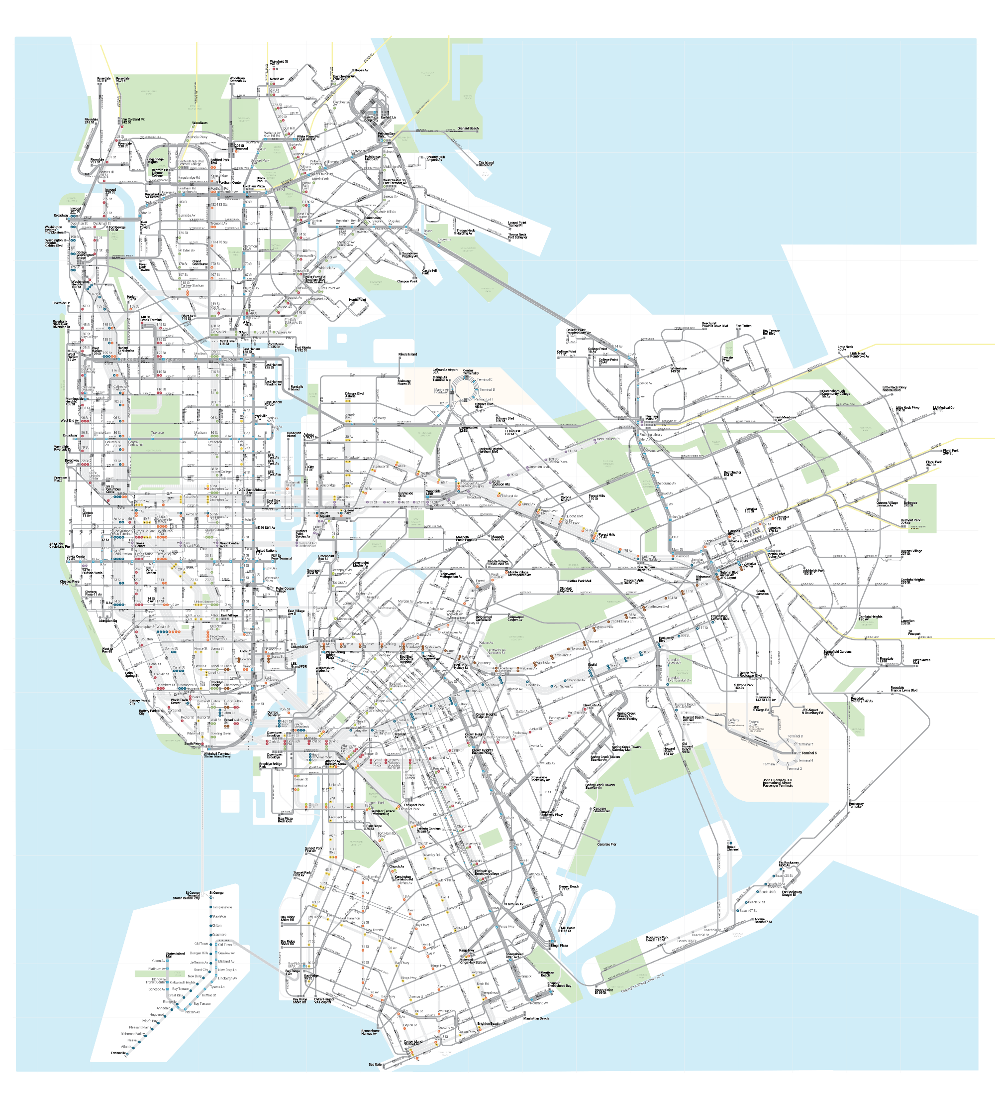
Denaro’s synthesized the bus stops with the subway stations, which means you don’t have to endure another delay in a cramped subway car. Hopefully not, anyway.
His map, which he calls “The Bullet Map,” isn’t available in print yet, so check it out here.
[via Medium] [Feature Image Courtesy Medium]