

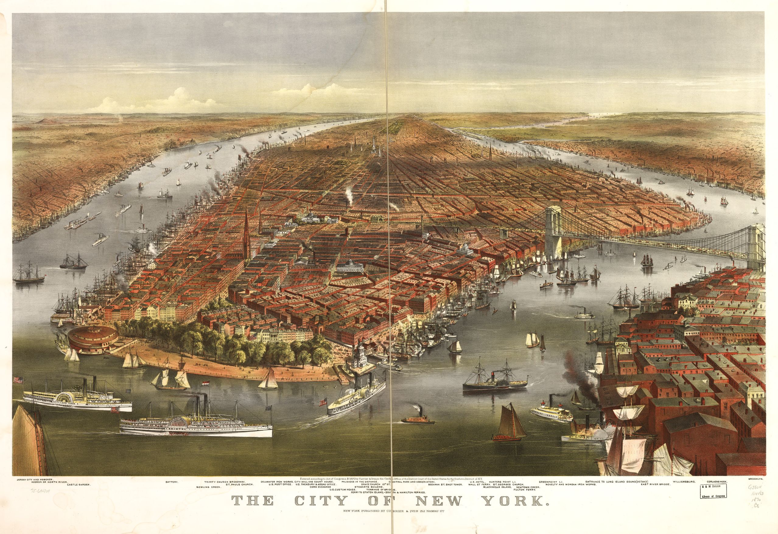
New York City was a much different place in the 1870s. What, don't you remember? Kidding. Of course not.
The latter part of the 19th century was a time where boats speckled the Hudson, and the skyline was a lot less crowded.
In a time where photography was still in its early stages of development, maps were a great way for people to understand the lay of the land when they couldn't travel it for themselves.
These maps were created by printmakers, Currier & Ives. The two were based in New York City from 1834-1907, distributing paintings and prints that were colored by hand.
According to Viewing NYC, this map was published in 1870. Due to the fact that the construction of the Brooklyn Bridge began in 1870, the artist of of this map drew it in how it was expected to look at completion, and was titled "East River Bridge," because the bridge was not officially named.
Check out the larger scan on the this Library of Congress archives page.
[anad]
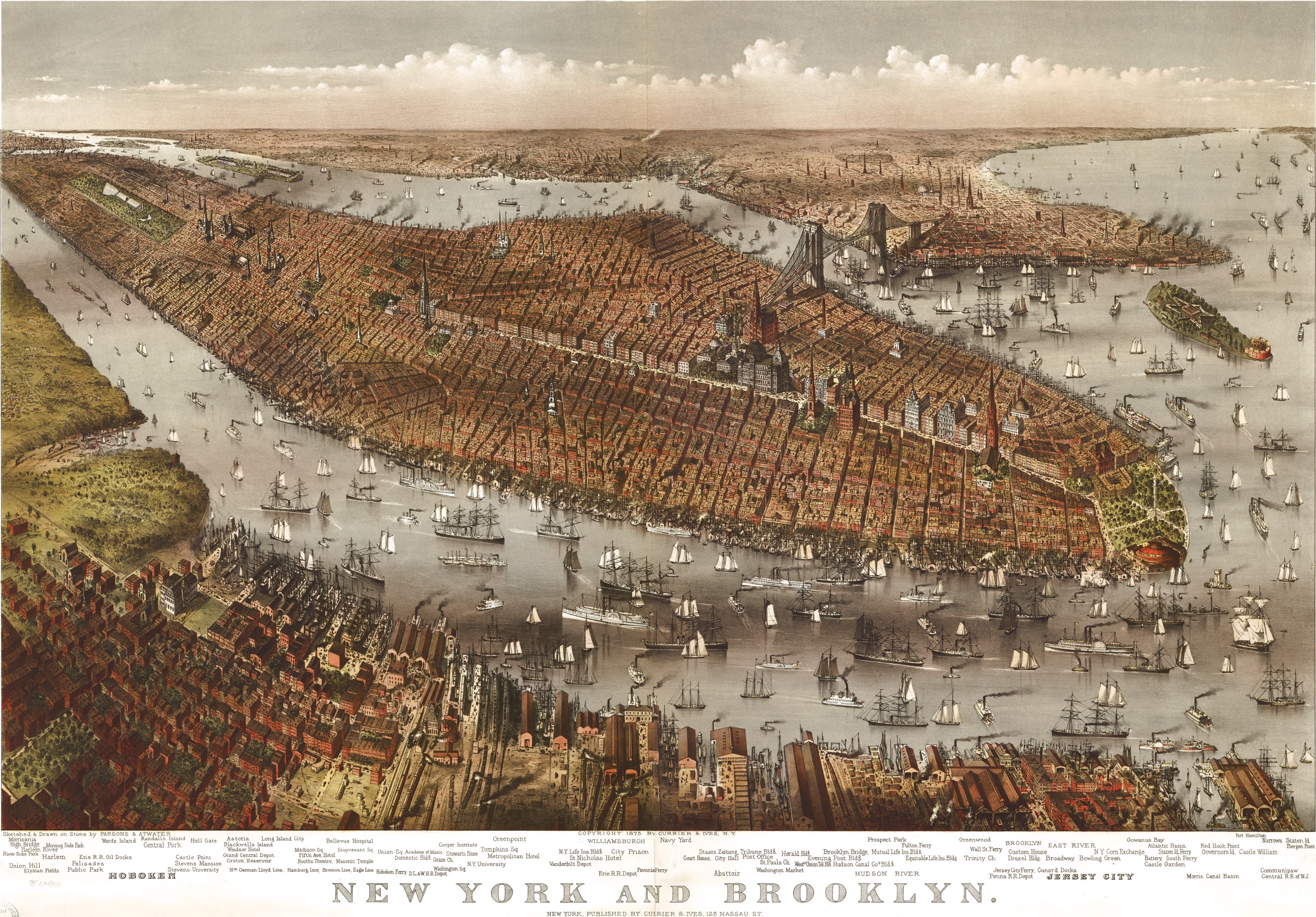
This second map from the same printmakers, shows views of New York City and Brooklyn from above circa 1875. You can also view parts of Hoboken, New Jersey. Check out the specimen page from the Library of Congress archives here.
Check out These Wonderful Colored Photos of NYC in the 1960s.