

In New York City everyone has to use the subway once in a while - many everyday, some once in a blue moon, and a select few get a chance to share it with dead crabs.
If you're really lucky, the subway is just around the corner, so you can get home easier from those drunken-stupor-commutes. Unfortunately, much of the city has a commute before their regular subway commute, a phenomenon that's easier to show than tell.
Chris Whong has made a map that shows a ten minute walkshed around 470 NYC subway stations that makes you either really appreciate where you live, or sigh the same sigh you make every morning before you head out on your commute.
We've talked about Whongs maps before. Last August, he made his first "subway desert" map that showed all the places throughout NYC that are farther than 500 meters from the subway.
500 meters isn't much. In fact it's .3 miles. So, Whong created this map that used a ten minute walk to show how many people have to travel far just to get to the subway.
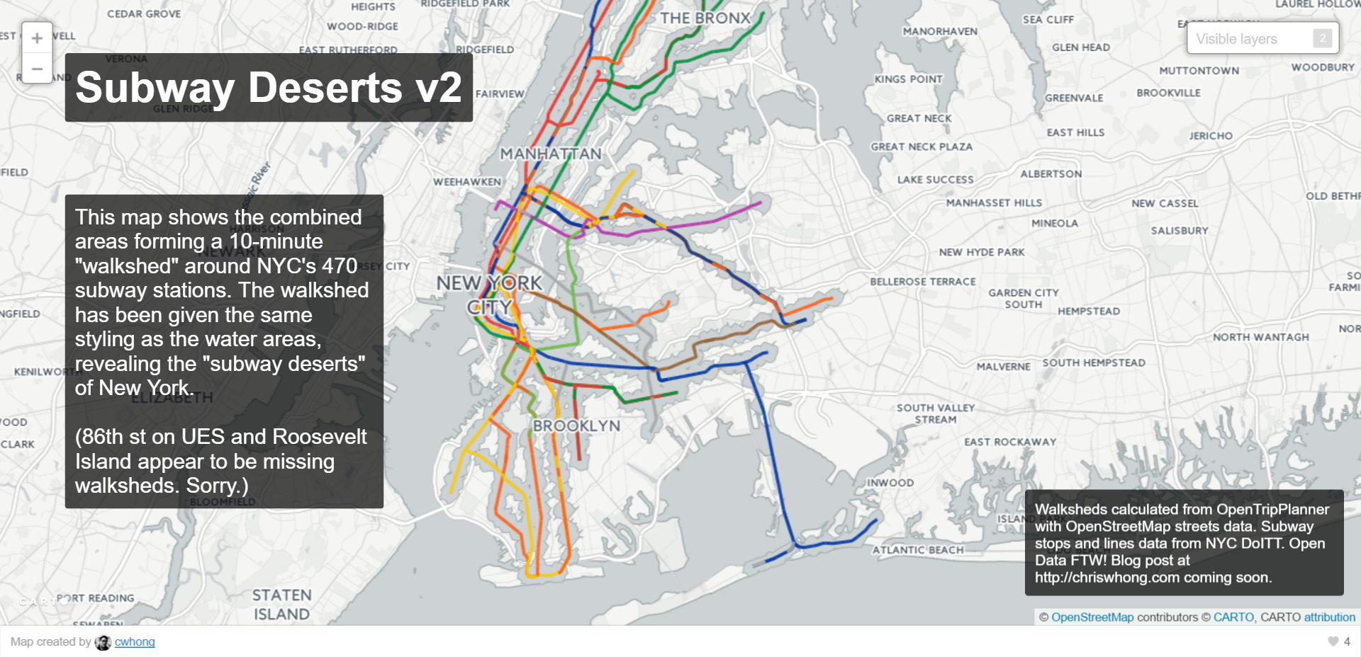
In certain parts of Queens and Brooklyn, residents have to walk pretty far to get to a subway station.
Whong hopes this will make people appreciate where they live and also question the worth of visiting some places in the city because of how far some subway lines are.
[anad]
But, don't worry Chris Whong, Pokemon Go is going to get us to explore everywhere and even fall into some real life water.
You can find the entire interactive map here.
Check out 8 Best Free Year-Round Attractions in NYC.
[via Gothamist] [Feature Image Courtesy Chris Whong]