




New York City's famous skyline has always been changing. Of course certain structures represent given times in history when development served multiple purposes.
Not only did an entire generation of men grow up building and maintaining these edifices, but the structures themselves were megalithic symbols of corporate power and wealth, two things NYC has up to the ears.
But as of 2004, Manhattan had 28 skyscrapers measuring 700 feet tall or more. Thirteen more have been built since, 15 are under construction and there are 19 more at the proposal stage. That's 47 skyscrapers.
National Geographic has taken a special interest in this explosion of skyscraper building in the world's most famous skyscraper city, NYC.
They've assembled an interactive 3-D map of what the skyline looks like now, including what buildings will be there in the future, and it's really eye-opening (to say the very least).
So, we've gone ahead and rounded up some screenshots of the main attractions. Buildings in blue were completed between 2004-2015; buildings in yellow are proposed; and buildings in orange are under construction.
1. World Trade Center Area
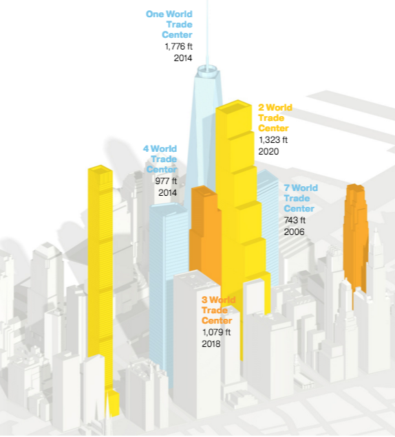
World Trade Center via NatGeo
2. Hudson Yards
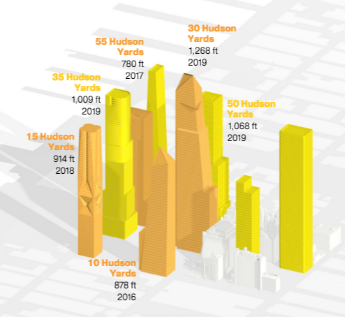
Hudson Yards via NatGeo
3. Billionaire's Row
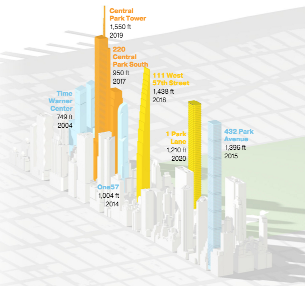
Billionaire's Row via NatGeo
Check out 4 NYC Subway Maps That Are Actually Easier to Read Than the Real Thing.
[via National Geographic]