




We recently discovered this map on Reddit, and just had to share it with our readers.
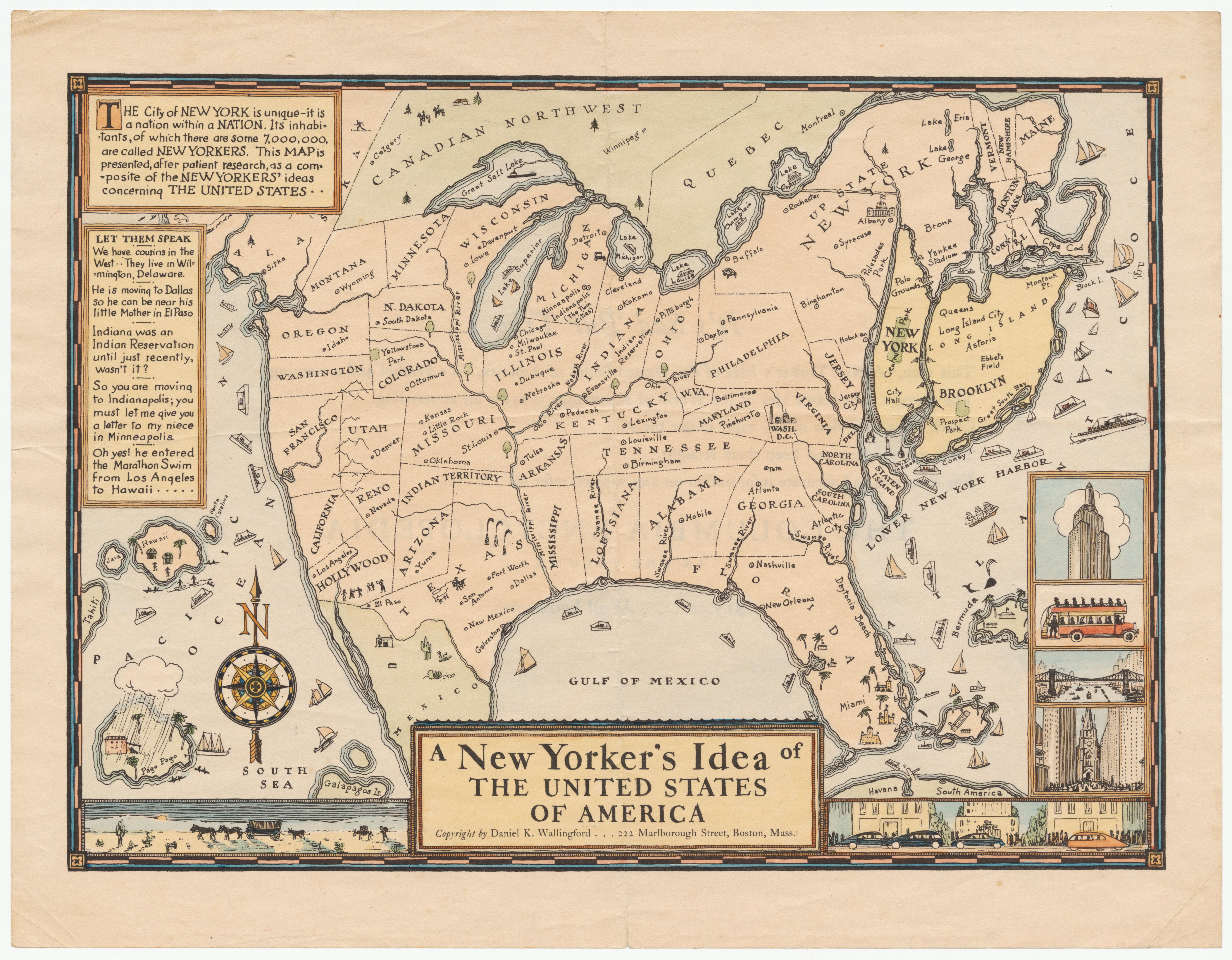
As Ambamja stated, "This humorous pictorial map of the United States takes the perspective of a New Yorker, with New York shown in oversized proportion to the entire country...
A parody of the self-centered-- and geographically illiterate New Yorker: Minneapolis and Indianapolis are shown together in Michigan as 'The Twin Cities;' four 'Swanee Rivers' cross the South; the great lakes include 'Great Salt Lake' and 'Lake Louise;' Alaska abuts Montana and Oregon; Hawaii is adjacent to Java and Tahiti.
The text makes the same point, for example, 'We have cousins in the West. . . They live in Wilmington, Delaware.'
This map was distributed by the Columbia University Press at the 1936 New York Times bookfair. As the verso shows, it was an advertising flyer for the newly published Columbia Encyclopedia In One Volume.
This map anticipates by 40 years Saul Steinberg's famous New Yorker cover, 'View of the World from Ninth Avenue.'"
via Reddit
Check out Here’s Exactly How New Yorkers See the Rest of the World.