

We love maps; we think they're the absolute coolest. What we love more than maps? Maps that let us time travel, of course.
We were blown away when the New York Public Library unleashed an interactive map of New York's antique photos.
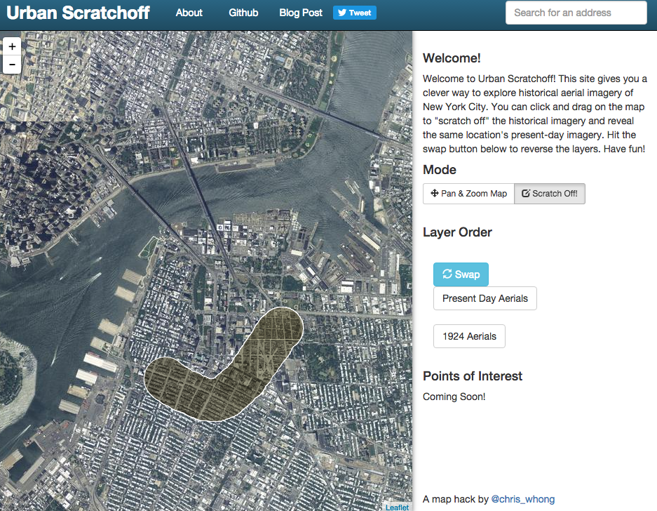
Now, we're even more blown away by Urban Scratchoff's interactive map, which allows you to explore an aerial map of NYC in the 1920s.
How the scratch-off map works. You start off staring at a birds-eye view of New York in the 1920s, and then you, using your computer mouse of course, scratch off an area of the picture.
Then, underneath the area you scratched, you can see a present-day birds eye view. Or, you can reverse the picture, and see a present-day birds eye view with 1920s New York scratched off.
If you love maps, and you're curious about the history of the city, you need to check this out. It will absolutely astonish you.
[anad]
Check out the map here, and prepare to be amazed. Suffice it to say that the city's changed a lot in the nearly century that these two maps have been juxtaposed.
Check out This Map of Historical Photos of NYC.